
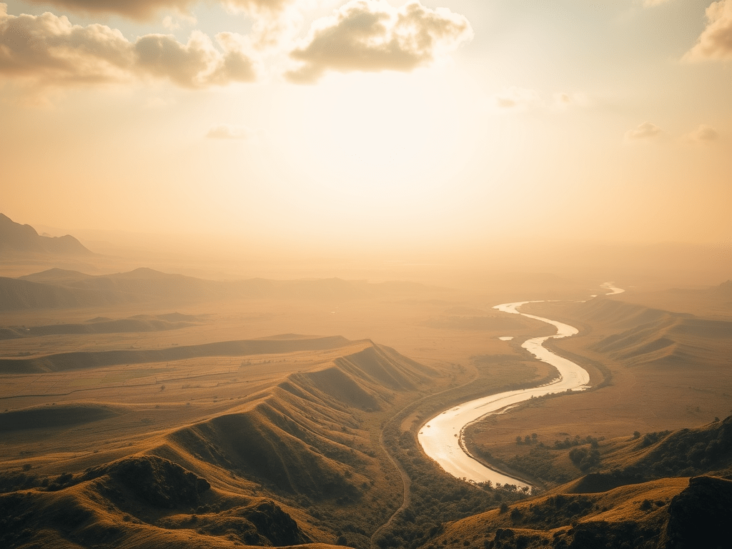
What Is the Indo-Gangetic Plain?
- Definition: A large, flat plain made of alluvial soil (mud, sand, and gravel) deposited by rivers like the Indus, Ganga, and Brahmaputra.
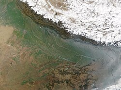
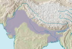
- Location: Stretches across northern India, from Punjab in the west to West Bengal and Assam in the east, and parts of southern Nepal and Bangladesh.
- Extent: Covers about 7 lakh sq. km in India, running parallel to the Himalayas.
- Role: Supports agriculture, dense population, and major cities; acts as India’s economic and cultural heartland.
How Was the Indo-Gangetic Plain Formed?
The Indo-Gangetic Plain was created over millions of years due to river activity and tectonic movements. Here’s a simple explanation:
- Tethys Sea and Himalayas:
- Millions of years ago, the Tethys Sea existed between the Indo-Australian and Eurasian tectonic plates.
- When these plates collided, the Himalayas were formed, and the Tethys Sea disappeared.
- Depression Created:
- The collision caused a large depression (low-lying area) south of the rising Himalayas, called a foredeep basin.
- River Deposits:
- Rivers like the Indus, Ganga, and Brahmaputra, originating in the Himalayas, carried huge amounts of mud, sand, and rocks (sediments).
- These sediments were deposited in the foredeep basin over millions of years.
- Formation of Plain:
- The continuous deposition of alluvial soil filled the basin, creating the flat and fertile Indo-Gangetic Plain.
- The process still continues, as rivers keep adding soil during floods.
Features of the Indo-Gangetic Plain
- Flat Terrain: Almost level land with a gentle slope (from west to east), making it ideal for farming and transport.
- Alluvial Soil:
- Rich, fertile soil made of silt, clay, and sand brought by rivers.
- Types: Khadar (newer, flood-prone, very fertile) and Bangar (older, less fertile, above flood level).
- Rivers: Major rivers include Indus, Ganga, Yamuna, Brahmaputra, and tributaries like Sutlej, Beas, Ghaghara, and Kosi.
- Climate: Varies from semi-arid in the west (Punjab, Haryana) to humid in the east (Bihar, West Bengal). Monsoon brings heavy rain.
- Width: Wider in the west (Punjab, ~300 km) and narrower in the east (Assam, ~90 km).
Divisions of the Indo-Gangetic Plain
The Indo-Gangetic Plain is divided into three main regions based on rivers and geography:
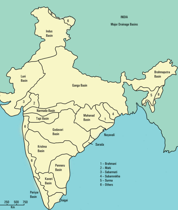
- Indus Plain (Western Part):
- Covers Punjab, Haryana, parts of Rajasthan, and western Uttar Pradesh.
- Formed by the Indus River and its tributaries (Sutlej, Beas, Ravi, Chenab, Jhelum).
- Features:
- Fertile soil, ideal for wheat and sugarcane.
- Semi-arid climate with less rainfall.
- Includes the Thar Desert’s edge in Rajasthan.
- Example: Punjab’s “Land of Five Rivers” (Panj-ab).
- Ganga Plain (Central Part):
- Largest part, covering Uttar Pradesh, Bihar, and parts of Jharkhand and West Bengal.
- Formed by the Ganga River and its tributaries (Yamuna, Ghaghara, Kosi, Son).
- Features:
- Very fertile, supports rice, wheat, pulses, and sugarcane.
- Dense population with cities like Delhi, Kanpur, Patna, and Varanasi.
- Sub-divisions:
- Upper Ganga Plain: Western UP (Yamuna-Ganga Doab).
- Middle Ganga Plain: Eastern UP, Bihar (flood-prone due to Kosi, “River of Sorrow”).
- Lower Ganga Plain: West Bengal (delta region).
- Brahmaputra Plain (Eastern Part):
- Covers Assam and parts of Arunachal Pradesh.
- Formed by the Brahmaputra River and its tributaries.
- Features:
- Narrower plain, surrounded by hills.
- Fertile for rice, tea, and jute.
- Heavy rainfall, frequent floods.
- Includes the world’s largest river island, Majuli (Assam).
Regional Divisions of the Indo-Gangetic Plain
For exams, the plain is sometimes divided into smaller regions:
- Rajasthan Plain:
- Westernmost, near Thar Desert.
- Semi-arid, less fertile, supports millets and pulses.
- Includes the Luni River basin.
- Punjab-Haryana Plain:
- Fertile, formed by Indus tributaries.
- Known for wheat (Green Revolution success).
- Cities: Chandigarh, Amritsar, Ludhiana.
- Upper Ganga Plain:
- Western UP, fertile doabs (land between rivers).
- Crops: Wheat, sugarcane, pulses.
- Cities: Meerut, Agra, Delhi.
- Middle Ganga Plain:
- Eastern UP, Bihar; flood-prone.
- Crops: Rice, wheat, maize.
- Cities: Lucknow, Patna.
- Lower Ganga Plain:
- West Bengal, includes Ganga Delta (Sundarbans).
- Crops: Rice, jute.
- Features: Mangrove forests, high rainfall.
- Brahmaputra Plain:
- Assam, narrow valley.
- Crops: Tea, rice, jute.
- Features: Floods, biodiversity.
Significance of the Indo-Gangetic Plain
- Agriculture:
- Called the “Food Basket of India” due to fertile soil.
- Major crops: Rice, wheat, sugarcane, pulses, cotton, jute, tea.
- Supports Green Revolution and food security.
- Population:
- Home to over 40% of India’s population (densely populated).
- Major cities: Delhi, Kolkata, Patna, Lucknow, Kanpur.
- Economy:
- Agriculture-based industries (sugar, textiles, food processing).
- Trade and transport hub due to flat terrain and rivers.
- Culture:
- Cradle of ancient civilizations (Indus Valley, Vedic culture).
- Religious centers: Varanasi, Haridwar, Allahabad (Prayagraj).
- Water Resources:
- Rivers provide water for irrigation, drinking, and hydropower.
- Canals like Indira Gandhi Canal (Rajasthan) support farming.
- Transport:
- Flat land ideal for roads, railways, and waterways.
- Connects northern India with ports like Kolkata.
Exam Tip: Structure significance answers: Agriculture → Population → Economy → Culture → Water → Transport. Use examples (e.g., Varanasi, Green Revolution).
Challenges Facing the Indo-Gangetic Plain
- Floods:
- Rivers like Kosi and Brahmaputra cause frequent floods, damaging crops and homes.
- Waterlogging and Salinity:
- Over-irrigation leads to waterlogged soil and salt buildup, reducing fertility.
- Soil Degradation:
- Intensive farming and chemical fertilizers harm soil health.
- Pollution:
- Rivers (e.g., Ganga, Yamuna) are polluted by industrial waste and sewage.
- Air pollution in cities like Delhi affects health.
- Overpopulation:
- High population density strains resources like water, land, and housing.
- Climate Change:
- Changing monsoon patterns and rising temperatures affect farming.
- Solutions:
- Build better flood control systems (dams, embankments).
- Promote sustainable farming (organic methods, crop rotation).
- Clean rivers through programs like Namami Gange.
Frequently Asked Questions (FAQs) for Exams
- Where is the Indo-Gangetic Plain located?
- Northern India, from Punjab to Assam, south of the Himalayas.
- What is the Indo-Gangetic Plain?
- A flat, fertile plain formed by alluvial deposits of Indus, Ganga, and Brahmaputra rivers.
- How was the Indo-Gangetic Plain formed?
- Himalayan uplift created a depression; rivers deposited alluvium over millions of years.
- Why is it called the Food Basket of India?
- Fertile soil supports major crops, feeding India’s population.
- What are the divisions of the Indo-Gangetic Plain?
- Indus Plain, Ganga Plain, Brahmaputra Plain.
Exam Tip: FAQs are common in prelims. Memorize short, precise answers.
Exam-Oriented Tips for UPSC/BPSC Aspirants
- Key Points to Memorize:
- Rivers: Indus, Ganga, Brahmaputra, Yamuna, Kosi, Sutlej.
- Crops: Wheat (Punjab), rice (Bengal), jute (Assam).
- Cities: Delhi, Kolkata, Patna, Varanasi, Chandigarh.
- Features: Khadar, Bangar, Doabs, Sundarbans, Majuli.
- Map Practice:
- Mark the plain’s extent, rivers, and divisions on India’s map.
- Label states and key cities.
- Answer Writing:
- Use headings: Formation, Features, Divisions, Significance, Challenges.
- Include diagrams: River deposition, plain divisions.
- For significance, write in points with examples (e.g., Green Revolution, Ganga Delta).
- Link to Current Affairs:
- Mention Namami Gange, flood management, or climate change impacts.
- Discuss sustainable agriculture for environmental questions.
- Revision Strategy:
- Make a table of divisions, rivers, and crops.
- Revise FAQs and challenges with solutions.
Quick Revision Table
| Topic | Key Points |
|---|---|
| Formation | Himalayan uplift → Depression → River alluvium → Indo-Gangetic Plain. |
| Features | Flat, fertile alluvial soil (Khadar, Bangar), major rivers, gentle slope. |
| Divisions | Indus Plain (Punjab), Ganga Plain (UP, Bihar, WB), Brahmaputra Plain (Assam). |
| Significance | Agriculture, population, economy, culture, water, transport. |
| Challenges | Floods, pollution, soil degradation, overpopulation, climate change. |

Leave a comment